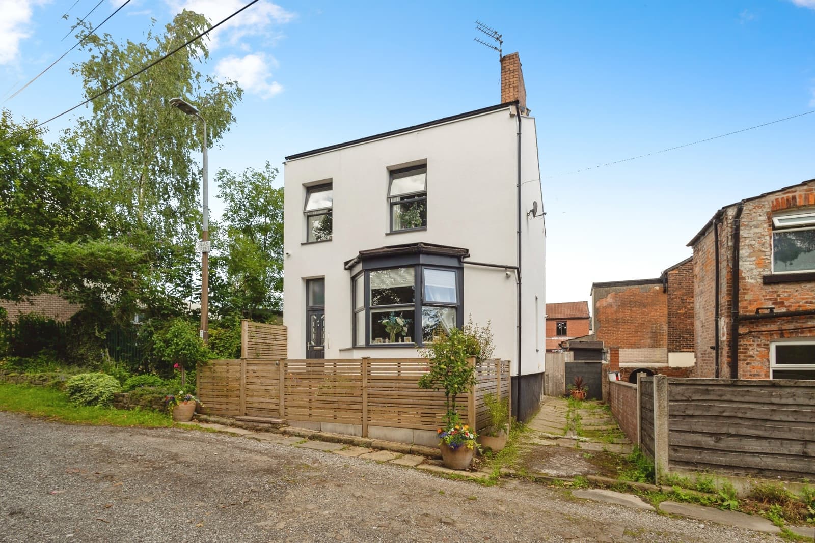
5 Silas Street, Ashton-under-Lyne, OL6 8EU
UPRN:100012741388Detached House3 bedsBuilt before 1900
LeaseholdCouncil Tax: -EPC: G (12)
Data freshness:Planning· 4mo agoPlanning: stale, refreshed 4mo ago (2026-07-10T08:23:12.015333+00:00)EPC· 5mo agoEPC: stale, refreshed 5mo ago (2026-05-20T10:58:39.129138+00:00)Risk· 2y agoRisk: stale, refreshed 2y ago (2024-12-31T00:00:00+00:00)Amenities· 1mo agoAmenities: ageing, refreshed 1mo ago (2026-09-23T00:00:00+00:00)Area· Census 2021Area: static reference data (Census 2021); authoritative and does not refresh
HP Score
71
/ 100
Mixed
Verdict
yesterday
- Verdict: INVESTIGATE, on a scale of Buy, Investigate, Avoid.
Mixed signals - investigate
Evidence
16 of 21 sourcesSale Estimate
£292,000
£277k - £306kHigh
Estimate
£292k
Range
£277k – £306k
Rent Estimate (pcm)
£1,650
£2k - £2k
Monthly
£1,650
Yield
7.33%
Verdict
Derived from HomePortfolio scores
5 Silas Street earns an INVESTIGATE rating with HP Score 71/100. Investment score 55/100 reflects moderate fundamentals. Walkability is good (76/100). Flood risk is not assessed: check the Environment Agency long-term flood map before offering. Tenure is leasehold. Every figure here comes from the live HomePortfolio API; anything it does not publish is left out.
Key SourcesEPC RegisterPortal listingsOfcom Connected NationsOfcom mobile coverageMarket estimates (third-party AVM)Defra strategic noise mapping, England Round 4 (Contains Defra data © Crown copyright and database right 2023-2024, Open Government Licence v3.0)Walk ScoreONS Census 2021Police.ukHM Land Registry leasesPlanIt / council planning portalsOverture Maps PlacesOfsted / DfE GIAS
71
HP Score
71/ 100
Mixed
55
Investment Score
55/ 100
Moderate
-
Crime Score
No data
76
Walkability
76/ 100
High
Transit & Bike
Transit 53Bike 29
Walk Score, out of 100
Valuation & Market
Sale Estimate£292,000
Rent Estimate (pcm)£1,650
Gross Yield7.33%
1y Growth-
3y Growth-0.4%
5y Growth+4.8%
10y Growth+5.4%
Last Sold Price-
Risk Overview
- Flood RiskUnknown
- SubsidenceLow
- RadonLow
- MiningUnknown
- LandslideSignificant
- Air QualityLow
- NoiseLow
Planning Activity
Recent Apps
0OL6 8EU
Approval Rate
-12mo
Development
low
- Approved26/00679/CLUDLawful Development Certificate for Existing Use: Conversion of the property from residential (Use Class C3) to HMO for up to 4 persons (Use Class C4), with the C4 use having continued without material interruption since 24 January 2025
- Approved26/00578/HHPDSingle storey rear extension. The length of the extension from the rear of the original house by 4.0m. Maximum height of the extension 3.7m. Maximum height of eaves 2.30m
- Approved26/00463/NPVPrior approval for installation of Roof Mounted Solar PV Panels at the above site under Schedule 2, Part 14, Class J of the Town and Country Planning (General Permitted Development) (England) Order 2015 (as amended). The Solar PV system will be 314.18 kWp, to be installed across both pitched and flat roof areas of the building.
Ownership
- Corporate Ownership65.9%
- Overseas OwnershipNo
- Lease Term Remaining851 yrs
- CovenantsNone
- Lease TypeLeasehold
- Last Ownership Change-
- SourceLand Registry
Connectivity
Broadband (Standard)
13 Mbps
Mobile 4G/5G Coverage
EEThreeO2Vodafone
EV Charger
-
PTAL Rating
-
Area Profile
Median EarningsLocal authority£29,877
Population Density-
Owner Occupied56%
Age Distribution
0-15 21%16-64 64%65+ 15%
Schools Nearby
- Hurst Knoll St James' Church of England Primary School0.3 miReport card2026
Ofsted no longer awards a single overall grade.
- St Christopher's RC Primary School, a Voluntary Academy0.3 miGood
- Oasis Academy Broadoak0.3 miReport card2026
Ofsted no longer awards a single overall grade.
- Dixons Ashton Academy0.4 miArea grades2025
Inspected after Ofsted withdrew the single overall grade.
5 of 12 nearby schools with published figures were oversubscribed in 2026 - demand, not a catchment.