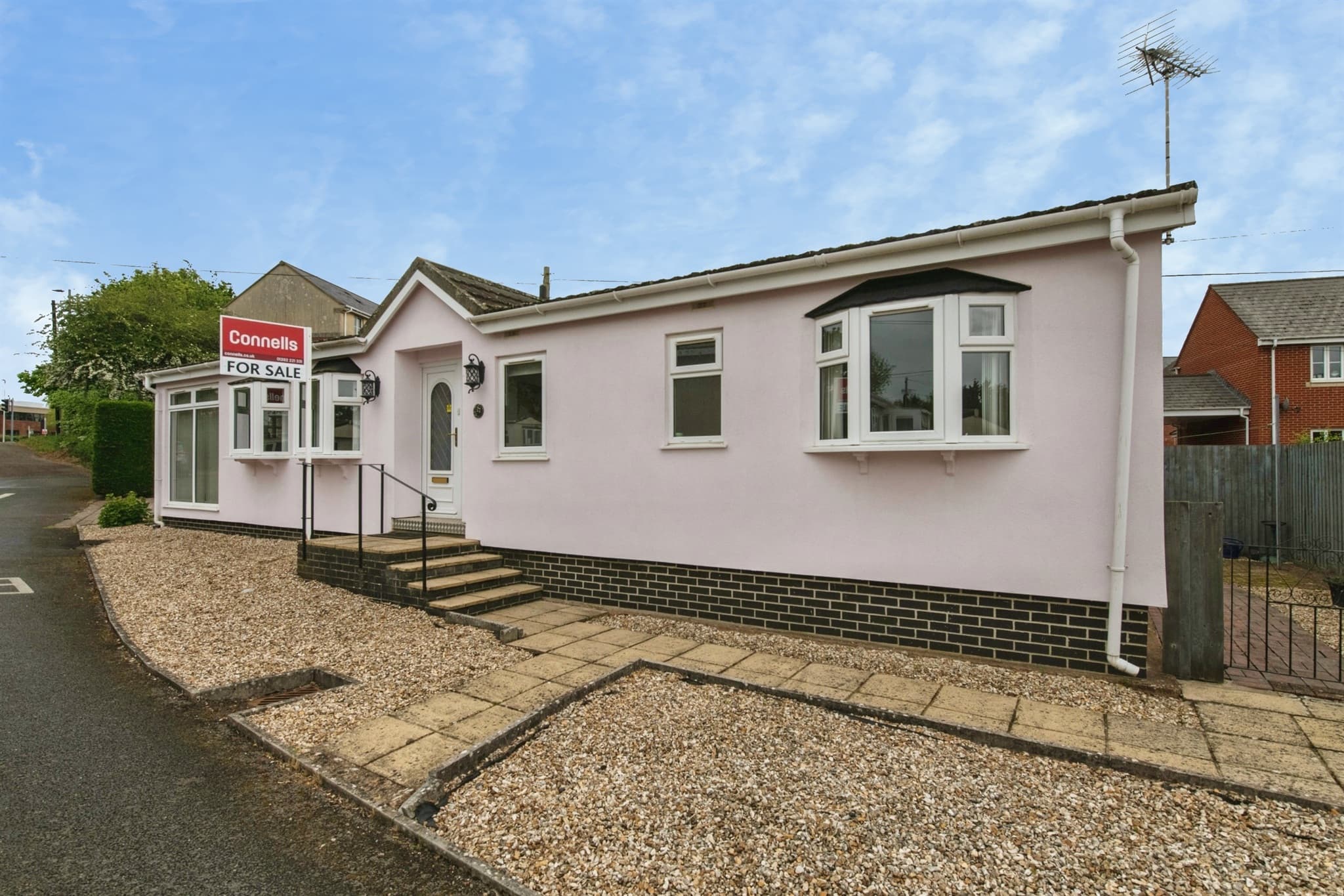
27 Rydon Park, Rydon Lane, Exeter, EX2 7HW
UPRN:100040232617Detached Property2 bedsBuilt -
FreeholdCouncil Tax: Band AEPC: -
Data freshness:Listing· freshListing: fresh, refreshed 2d ago (2026-10-24T04:00:05.961683+00:00)Planning· 4mo agoPlanning: stale, refreshed 4mo ago (2026-07-10T09:37:58.076036+00:00)Risk· 2y agoRisk: stale, refreshed 2y ago (2024-12-31T00:00:00+00:00)Amenities· 1mo agoAmenities: ageing, refreshed 1mo ago (2026-09-23T00:00:00+00:00)Area· Census 2021Area: static reference data (Census 2021); authoritative and does not refresh
HP Score
75
/ 100
Strong
Verdict
yesterday
- Verdict: INVESTIGATE, on a scale of Buy, Investigate, Avoid.
Strong fundamentals; flood risk not assessed
Evidence
16 of 21 sourcesSale Estimate
£173,000
£156k - £191kMedium
Estimate
£173k
Range
£156k – £191k
Rent Estimate (pcm)
£800
£750 - £850
Monthly
£800
Yield
5.65%
Verdict
Derived from HomePortfolio scores
27 Rydon Park earns an INVESTIGATE rating with HP Score 75/100. Investment score 56/100 reflects moderate fundamentals. Crime intensity is very low. Walkability is limited (62/100). Flood risk is not assessed: check the Environment Agency long-term flood map before offering. Tenure is freehold. Every figure here comes from the live HomePortfolio API; anything it does not publish is left out.
Key SourcesPortal listingsOfcom Connected NationsOfcom mobile coverageMarket estimates (third-party AVM)Defra strategic noise mapping, England Round 4 (Contains Defra data © Crown copyright and database right 2023-2024, Open Government Licence v3.0)Walk ScoreONS Census 2021Police.ukHM Land Registry company ownershipHM Land Registry covenantsPlanIt / council planning portalsOverture Maps PlacesOfsted / DfE GIAS
75
HP Score
75/ 100
Strong
56
Investment Score
56/ 100
Moderate
11
Crime Score
11/ 100
Low
62
Walkability
62/ 100
Moderate
Transit & Bike
Transit 30Bike 52
Walk Score, out of 100
Valuation & Market
Sale Estimate£173,000
Rent Estimate (pcm)£800
Gross Yield5.65%
1y Growth-
3y Growth-3.7%
5y Growth+0.8%
10y Growth+2.0%
Last Sold Price-
Risk Overview
- Flood RiskUnknown
- SubsidenceLow
- RadonLow
- MiningUnknown
- LandslideModerate
- Air QualityLow
- NoiseModerate
Planning Activity
Recent Apps
0EX2 7HW
Approval Rate
-12mo
Development
low
- Pending26/1472/TPOT5 Ash reduce to approx 3m habitat stick G4 Ash crown reduce group to provide 2m clearance from building. Prune tagged stem (01425) back to source due to lack of available pruning points
- Pending26/1433/FULProposed side and rear extension
- Approved26/1372/TPOT006 Common lime(Tilia x vulgaris) - Remove epicormic growth immediately prior to next inspection., Sever ivy and allow to die off naturally. T008 Silver birch(Betula pendula) - Crown raise to provide a minimum of 2.5 meters vertical clearance over the adjacent pedestrian route to the South. T009 Wild cherry (Prunus avium) - Crown raise to provide a minimum of 2.5 meters vertical clearance over the adjacent pedestrian route to the South.
Ownership
- Corporate Ownership58.9%
- Overseas OwnershipNo
- Lease Term Remaining-
- CovenantsRestrictive
- Lease TypeFreehold
- Last Ownership Change-
- SourceLand Registry
Connectivity
Broadband (Standard)
7 Mbps
Mobile 4G/5G Coverage
EEThreeO2Vodafone
EV Charger
-
PTAL Rating
-
Area Profile
Median EarningsLocal authority£29,531
Population Density-
Owner Occupied47%
Age Distribution
0-15 22%16-64 69%65+ 9%
Schools Nearby
- Clyst Heath Nursery and Community Primary School0.2 miGoodConcerns
- St Peter's Church of England Aided School0.2 miArea grades2025
Inspected after Ofsted withdrew the single overall grade.
- Woodwater Academy0.3 miGood
- Stansfield Academy0.5 miArea grades2025
Inspected after Ofsted withdrew the single overall grade.
2 of 9 nearby schools with published figures were oversubscribed in 2026 - demand, not a catchment.