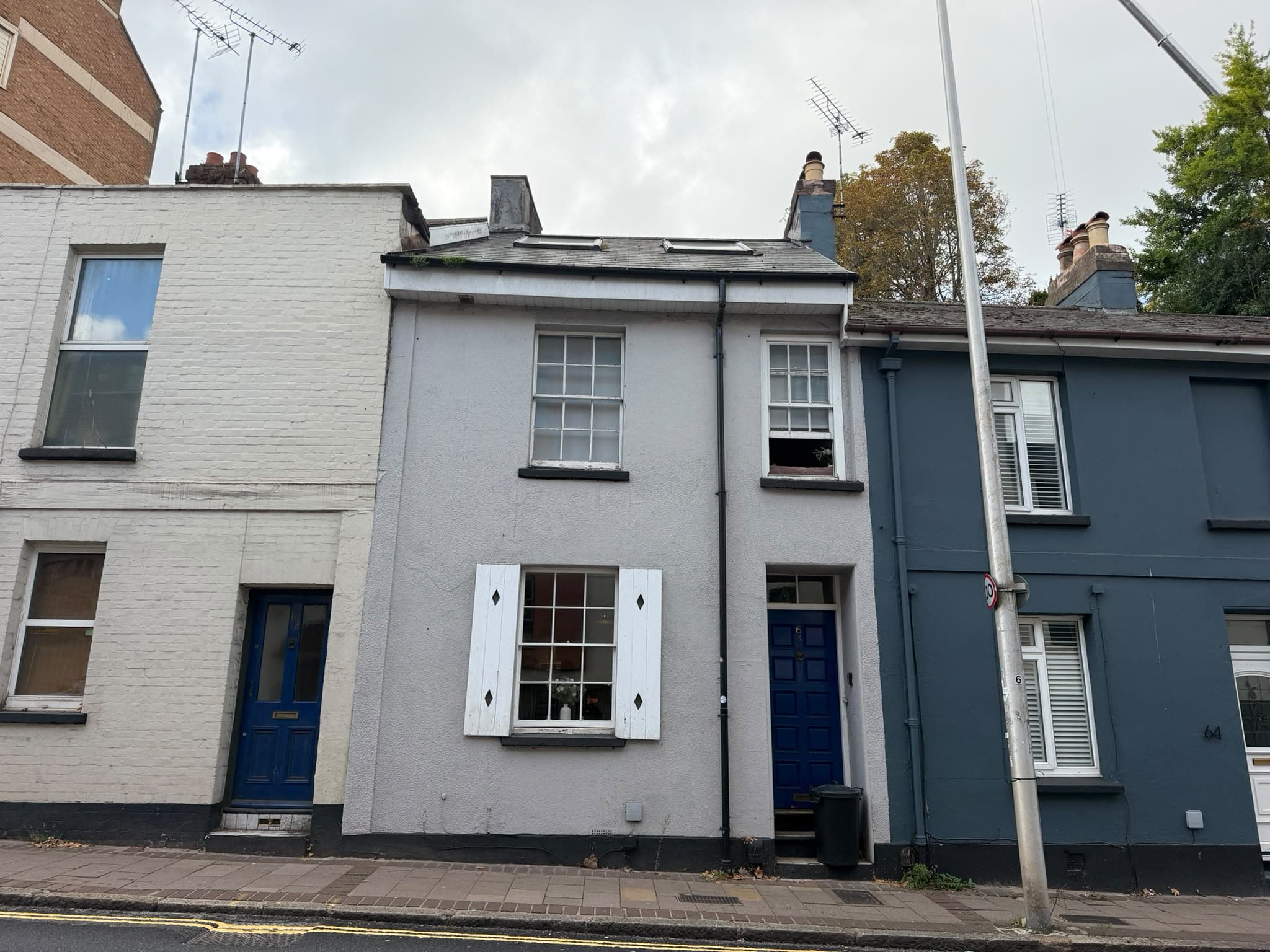
63 New North Road, Exeter, EX4 4EP
UPRN:100040225439Terrace Property6 bedsBuilt before 1900
FreeholdCouncil Tax: Band BEPC: C (73)
Data freshness:Listing· freshListing: fresh, refreshed 5d ago (2026-10-19T04:00:02.130848+00:00)Planning· 1mo agoPlanning: ageing, refreshed 1mo ago (2026-09-14T07:06:56.267248+00:00)EPC· 5mo agoEPC: stale, refreshed 5mo ago (2026-05-20T10:58:39.129138+00:00)Risk· 2y agoRisk: stale, refreshed 2y ago (2024-12-31T00:00:00+00:00)Amenities· 1mo agoAmenities: ageing, refreshed 1mo ago (2026-09-23T00:00:00+00:00)Area· Census 2021Area: static reference data (Census 2021); authoritative and does not refreshCouncil Tax· 4mo agoCouncil Tax: stale, refreshed 4mo ago (2026-07-03T07:41:16.386402+00:00)
HP Score
60
/ 100
Mixed
Verdict
2 days ago
- Verdict: INVESTIGATE, on a scale of Buy, Investigate, Avoid.
Mixed signals - investigate
Evidence
20 of 21 sourcesSale Estimate
£280,000
£224k - £336kLow
Estimate
£280k
Range
£224k – £336k
Rent Estimate (pcm)
£1,450
£1k - £2k
Monthly
£1,450
Yield
6.21%
Verdict
Derived from HomePortfolio scores
63 New North Road earns an INVESTIGATE rating with HP Score 60/100. Investment score 61/100 reflects moderate fundamentals. Crime intensity is elevated. Walkability is excellent (96/100). Flood risk is not assessed: check the Environment Agency long-term flood map before offering. Tenure is freehold. Every figure here comes from the live HomePortfolio API; anything it does not publish is left out.
Key SourcesEPC RegisterPortal listingsOfcom Connected NationsOfcom mobile coverageMarket estimates (third-party AVM)HM Land Registry sales matched to addressDefra strategic noise mapping, England Round 4 (Contains Defra data © Crown copyright and database right 2023-2024, Open Government Licence v3.0)Walk ScoreONS Census 2021Police.ukHM Land Registry company ownershipHM Land Registry covenantsHM Land Registry leasesHM Land Registry Price PaidPlanIt / council planning portalsOverture Maps PlacesOfsted / DfE GIAS
60
HP Score
60/ 100
Mixed
61
Investment Score
61/ 100
Moderate
100
Crime Score
100/ 100
Elevated
96
Walkability
96/ 100
Excellent
Transit & Bike
Transit 54Bike 67
Walk Score, out of 100
Valuation & Market
Sale Estimate£280,000
Rent Estimate (pcm)£1,450
Gross Yield6.21%
1y Growth-
3y Growth-1.1%
5y Growth+1.5%
10y Growth+3.0%
Last Sold Price£230,000 (2016-02-15)
Risk Overview
- Flood RiskUnknown
- SubsidenceLow
- RadonModerate
- MiningLow
- LandslideModerate
- Air QualityLow
- NoiseModerate
Planning Activity
Recent Apps
2EX4 4EP
Approval Rate
-12mo
Development
low
- Pending26/1522/LEDCertificate of Lawfulness for the existing change of use from a dwellinghouse (Use Class C3) to a house in multiple occupation for seven occupants (sui generis)
- Pending26/1517/CATTo Crown lift two trees to improve clear lines of sight and prohibit anti-social behaviour. T1 - a holly tree. The branches of the tree currently reach to the ground and provide a dense canopy. The crown lifting of this tree's lower branches to 2-2.5 meters will reduce the potential for antisocial behaviour, improve the ground flora, and strengthen the health of the tree. T2 - a yew tree. The lower branches of this tree provide clover for anti-social behaviour without clear lines of sight, to crown lift this tree to 2-2.m meters will improve lines of sight, improve ground flora and improve the health of the tree by reducing the temptation to climb onto the lower branches.
- Pending26/1514/CATT1-is a multi stem Bay tree, one stem stops you closing the gate so this is to be removed & the height of other stems to be reduced to the height of the lower windows to stop it interfering with the BT lines & pole . Reduce height from 4metres down to 2 metres. T2-is a large conifer which is full of wisteria and is too close to the property& utilities. This will possibly affect household insurance, it also causes the front rooms to be in darkness. The plan is to remove this tree as a reducing it sympathetically will be impossible. T3-cordylines,these are reaching the height of the property & will soon be interfering with the BT lines above, the aim is to bring these down by half in the spring when chance of late frost is passed. Reduce in height from 5 metres down to 2.5 metres.
Ownership
- Corporate Ownership60%
- Overseas OwnershipNo
- Lease Term Remaining-
- CovenantsRestrictive
- Lease TypeFreehold
- Last Ownership Change2016-02-15
- SourceLand Registry
Connectivity
Broadband (Standard)
18 Mbps
Mobile 4G/5G Coverage
EEThreeO2Vodafone
EV Charger
-
PTAL Rating
-
Area Profile
Median EarningsLocal authority£29,531
Population Density-
Owner Occupied13%
Age Distribution
0-15 6%16-64 88%65+ 6%
Schools Nearby
- -Exeter Mathematics School0.1 mi
- St Sidwell's Church of England Primary School & Nursery0.3 miReport card2026
Ofsted no longer awards a single overall grade.
- -Exeter and North Devon Colleges Group0.4 mi
- Inspected by ISIExeter Cathedral School0.4 mi
2 of 8 nearby schools with published figures were oversubscribed in 2026 - demand, not a catchment.
Comparables
- 37 - 39 New North Road-£750k-
- 39 New North Road-£380k-
- 39 New North Road-£120k-
- 39 New North Road-£145k-