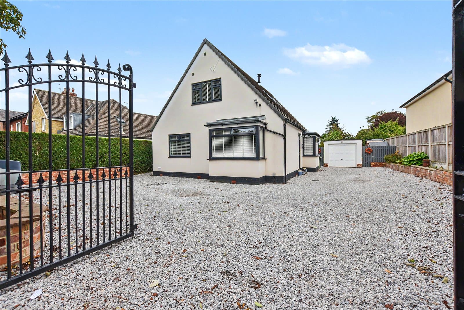
52 Station Road, Scholes, Leeds, LS15 4BT
UPRN:72321661Detached Bungalow2 bedsBuilt 1930-1949
FreeholdCouncil Tax: Band DEPC: D (67)
Data freshness:Listing· freshListing: fresh, refreshed 2d ago (2026-10-21T04:00:02.931607+00:00)Planning· 4mo agoPlanning: stale, refreshed 4mo ago (2026-07-10T08:08:12.017117+00:00)Risk· 2y agoRisk: stale, refreshed 2y ago (2024-12-31T00:00:00+00:00)Crime· freshCrime: fresh, refreshed 6d ago (2026-10-17T11:20:03.253738+00:00)Schools· 3mo agoSchools: ageing, refreshed 3mo ago (2026-08-06T07:49:20.947654+00:00)Amenities· 1mo agoAmenities: ageing, refreshed 1mo ago (2026-09-23T00:00:00+00:00)Area· Census 2021Area: static reference data (Census 2021); authoritative and does not refreshCouncil Tax· 4mo agoCouncil Tax: stale, refreshed 4mo ago (2026-07-03T07:41:16.386402+00:00)
HP Score
72
/ 100
Mixed
Verdict
today
- Verdict: INVESTIGATE, on a scale of Buy, Investigate, Avoid.
Mixed signals - investigate
Evidence
19 of 21 sourcesSale Estimate
£424,000
£339k - £509kLow
Estimate
£424k
Range
£339k – £509k
Rent Estimate (pcm)
£1,850
£2k - £2k
Monthly
£1,850
Yield
3.96%
Verdict
Derived from HomePortfolio scores
52 Station Road earns an INVESTIGATE rating with HP Score 72/100. Investment score 54/100 reflects moderate fundamentals. Crime intensity is very low. Walkability is limited (42/100). Flood risk is not assessed: check the Environment Agency long-term flood map before offering. Tenure is freehold. Every figure here comes from the live HomePortfolio API; anything it does not publish is left out.
Key SourcesEPC RegisterPortal listingsOfcom Connected NationsOfcom mobile coverageMarket estimates (third-party AVM)HM Land Registry sales matched to addressDefra strategic noise mapping, England Round 4 (Contains Defra data © Crown copyright and database right 2023-2024, Open Government Licence v3.0)Walk ScoreONS Census 2021Police.ukHM Land Registry company ownershipHM Land Registry covenantsHM Land Registry Price PaidPlanIt / council planning portalsOverture Maps PlacesOfsted / DfE GIAS
72
HP Score
72/ 100
Mixed
54
Investment Score
54/ 100
Moderate
9
Crime Score
9/ 100
Low
42
Walkability
42/ 100
Mixed
Transit & Bike
Transit 12Bike 48
Walk Score, out of 100
Valuation & Market
Sale Estimate£424,000
Rent Estimate (pcm)£1,850
Gross Yield3.96%
1y Growth-
3y Growth+1.0%
5y Growth+2.2%
10y Growth+4.5%
Last Sold Price£234,000 (2015-08-07)
Risk Overview
- Flood RiskUnknown
- SubsidenceLow
- RadonLow
- MiningUnknown
- LandslideLow
- Air QualityLow
- NoiseModerate
Planning Activity
Recent Apps
0LS15 4BT
Approval Rate
-12mo
Development
low
- Pending26/05695/TRT1 Beech: Raise lower crown by 2m over public footpath, draw back upper canopy by 2.5m to take weight off the branches as also hangs over the house roof, remove lower branch over roof to suitable growing points as per photos.
- Pending26/9/00154/MODReserved Matters planning application for matters relating to access, appearance, landscaping, layout and scale of the residential dwelling including the provision of 528 dwellings pursuant to outline application 20/04464/OT. NON MATERIAL AMENDMENT to 23/00848/RM A revision to the roof construction specification for detached garages and two-storey dwellings, resulting in a five-degree alteration to the finished roof pitch, and the addition of a shared 3-metre footpath/cycleway link.
- Pending26/04865/FURemoval of chimneys; construction of hip to gable end loft extension to include raising the height, dormer window to rear; roof lights to front and new dropped kerb to front
Ownership
- Corporate Ownership61.7%
- Overseas OwnershipNo
- Lease Term Remaining-
- CovenantsRestrictive
- Lease TypeFreehold
- Last Ownership Change2015-08-07
- SourceLand Registry
Connectivity
Broadband (Standard)
4 Mbps
Mobile 4G/5G Coverage
EEThreeO2Vodafone
EV Charger
-
PTAL Rating
-
Area Profile
Median EarningsLocal authority£31,679
Population Density636 /km²
Owner Occupied86%
Age Distribution
0-15 14%16-64 56%65+ 30%
Schools Nearby
- Scholes (Elmet) Primary School0.3 miGood
- Grimes Dyke Primary School0.7 miArea grades2025
Inspected after Ofsted withdrew the single overall grade.
- White Laith Primary School0.9 miGood
- John Smeaton Academy1.0 miGood
2 of 14 nearby schools with published figures were oversubscribed in 2026 - demand, not a catchment.
Comparables
- 56 Station Road-£350k-
- 50 Station Road-£275k-
- 48A Station Road-£346k-
- 52 Station Road-£234k-