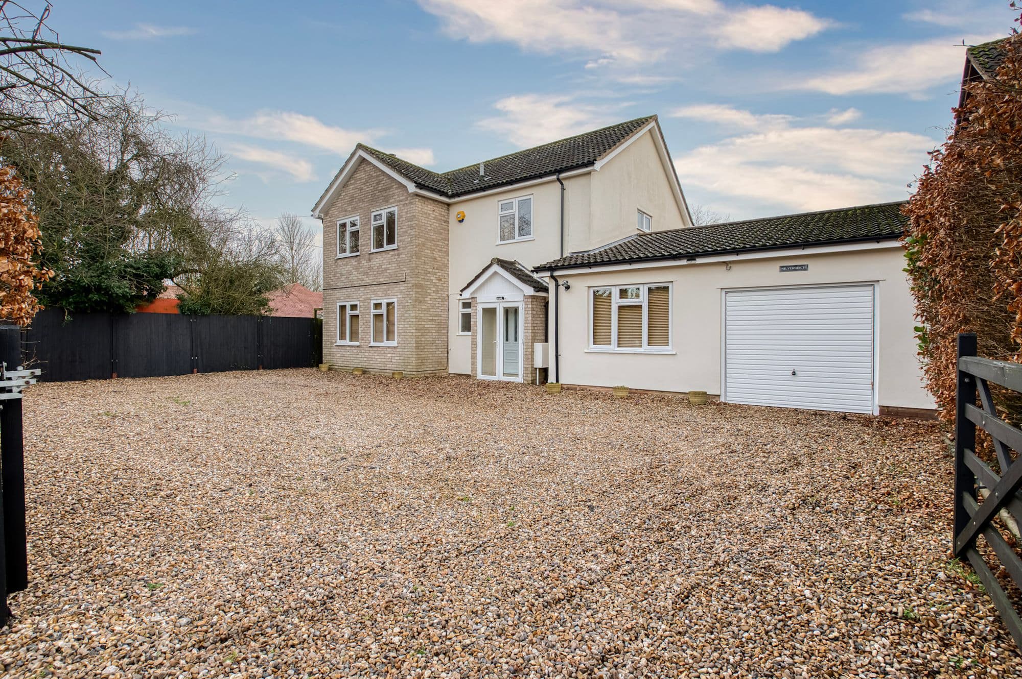
Silverbirch, The Street, Horham, Eye, IP21 5DX
UPRN:200003811178Detached House4 bedsBuilt 1967-1975
FreeholdCouncil Tax: Band EEPC: D (62)
Data freshness:Listing· freshListing: fresh, refreshed today (2026-11-13T04:00:06.044671+00:00)Ownership· freshOwnership: fresh, refreshed 3d ago (2026-11-10T18:39:48.974978+00:00)EPC· 6mo agoEPC: stale, refreshed 6mo ago (2026-05-20T10:58:39.129138+00:00)Risk· 5mo agoRisk: stale, refreshed 5mo ago (2026-06-18T00:00:00+00:00)Crime· freshCrime: fresh, refreshed 2d ago (2026-11-11T13:01:03.839912+00:00)Connectivity· 1mo agoConnectivity: ageing, refreshed 1mo ago (2026-10-03T06:43:10.905825+00:00)Schools· 1mo agoSchools: ageing, refreshed 1mo ago (2026-10-06T08:24:30.427161+00:00)Amenities· 2mo agoAmenities: ageing, refreshed 2mo ago (2026-09-23T00:00:00+00:00)Area· Census 2021Area: static reference data (Census 2021); authoritative and does not refreshCouncil Tax· 1mo agoCouncil Tax: ageing, refreshed 1mo ago (2026-10-11T17:51:50.707614+00:00)
HP Score
60
/ 100
Mixed
Verdict
today
- Verdict: INVESTIGATE, on a scale of Buy, Investigate, Avoid.
Mixed signals - investigate
Evidence
17 of 21 sourcesSale Estimate
£497,000
£472k - £522kHigh
Estimate
£497k
Range
£472k – £522k
Rent Estimate (pcm)
£1,500
£1k - £2k
Monthly
£1,500
Yield
3.60%
Verdict
Derived from HomePortfolio scores
Silverbirch earns an INVESTIGATE rating with HP Score 60/100. Investment score 56/100 reflects moderate fundamentals. Crime intensity is very low. Walkability is limited (19/100). Flood risk is not assessed: check the Environment Agency long-term flood map before offering. Tenure is freehold. Every figure here comes from the live HomePortfolio API; anything it does not publish is left out.
Key SourcesEPC RegisterPortal listingsOfcom Connected NationsMarket estimates (third-party AVM)Defra strategic noise mapping, England Round 4 (Contains Defra data © Crown copyright and database right 2023-2024, Open Government Licence v3.0)Walk ScoreONS Census 2021Police.ukHM Land Registry covenantsHM Land Registry leasesHM Land Registry Price PaidPlanIt / council planning portalsOverture Maps PlacesOfsted / DfE GIAS
60
HP Score
60/ 100
Mixed
56
Investment Score
56/ 100
Moderate
9
Crime Score
9/ 100
Low
19
Walkability
19/ 100
Low
Transit & Bike
Transit 4Bike 57
Walk Score, out of 100
Valuation & Market
Sale Estimate£497,000
Rent Estimate (pcm)£1,500
Gross Yield3.60%
1y Growth-
3y Growth-2.5%
5y Growth+0.1%
10y Growth+1.6%
Last Sold Price-
Risk Overview
- Flood RiskUnknown
- SubsidenceModerate
- RadonLow
- MiningUnknown
- LandslideLow
- Air QualityLow
- NoiseModerate
Planning Activity
Recent Apps
1IP21 5DX
Approval Rate
100%12mo
Development
low
- UnresolvedDC/26/01595Planning Application. Retrospective application for Gypsy & Travellers site for single family, including 2no. concrete hardstandings for affordable residential caravans, and associated Day Room.
- ConditionsDC/26/00717Discharge of Conditions Application for DC/25/04807 - 6 (Refuse and Recycling Storage), 10 (Wildlife Sensitive Design Scheme), 11 (Bat Mitigation Licence) and 12 (Construction Environmental Management Plan)
- ApprovedDC/25/05201Application to determine if Prior Approval is required for a proposed Change of Use of Agricultural Buildings to Dwellinghouses (C3) and for building operations reasonably necessary for conversion. Town and Country Planning (General Permitted Development)(England) Order 2015 as amended Schedule 2, Part 3, Class Q - Conversion of an agricultural building to 8no. residential units.
Ownership
- Corporate Ownership82.9%
- Overseas OwnershipNo
- Lease Term Remaining-
- CovenantsRestrictive
- Lease TypeFreehold
- Last Ownership Change-
- SourceLand Registry
Connectivity
Broadband (Standard)
1 Mbps
Mobile 4G/5G Coverage
-
EV Charger
-
PTAL Rating
-
Area Profile
Median EarningsLocal authority£31,507
Population Density40 /km²
Owner Occupied78%
Age Distribution
0-15 13%16-64 55%65+ 32%
Schools Nearby
- Stradbroke High School1.8 miGoodImproving
- Stradbroke Church of England Primary School2.0 miGood
- Wilby Church of England Primary School2.3 mi
Inspected as Wilby Church of England Voluntary Controlled Primary School (URN 124747) on 26 Nov 2019
- St Edmund's Primary School2.5 mi
Inspected as St Edmund's Primary School (URN 124591) on 12 Feb 2014
1 of 15 nearby schools with published figures were oversubscribed in 2026 - demand, not a catchment.
Comparables
- Purbeck Cottage The Street-£385k-
- Thirsville The Street-£345k-
- White House Cottage The Street-£200k-
- The Gables The Street-£335k-